
Fuel prices
Petrol and diesel prices in South East
Average pump prices across 1,056 filling stations in South East, from the prices every UK forecourt must now publish under the government’s Fuel Finder scheme. Checked 31 Oct, 19:32.
- Average unleaded petrol 173.4p 1.9p above the UK average
- Average diesel 200.3p 1.6p above the UK average
- Cheapest petrol 161.9p Nts Farnborough Service Station
- Filling stations 1,056 218 at supermarkets
Unleaded petrol averages 173.4p a litre across 825 forecourts in South East, 1.9p above the UK average. Diesel averages 200.3p, 1.6p above the UK average. The cheapest petrol is at Nts Farnborough Service Station in Farnborough, 161.9p; the dearest is 198.9p. The cheapest diesel is at Costco Wholesale Sunbury, 189.9p.
Cheapest petrol and diesel in South East
| Filling station | Price |
|---|---|
| Nts Farnborough Service Station Farnborough | 161.9p |
 Sainsbury's Watchmoor Park Camberley | 161.9p |
 Jet Bellingers Service Station Wantage | 162.9p |
| Costco Wholesale Sunbury Sunbury-On-Thames | 162.9p |
| Sainsbury's Wantage Wantage | 162.9p |
 MFG Morrisons Farnborough Southwood Southwood | 163.9p |
 Esso Hylands Service Station Leatherhead | 164.9p |
| Jet MFG Kingsmead Farnborough | 164.9p |
 Valero MFG Shirley Great Bookham | 164.9p |
 Asda Minster Express Petrol Ramsgate | 165.9p |
| Filling station | Price |
|---|---|
| Costco Wholesale Sunbury Sunbury-On-Thames | 189.9p |
| Nts Farnborough Service Station Farnborough | 191.9p |
| Sainsbury's Watchmoor Park Camberley | 191.9p |
| Shell Royal Oak Ramsgate | 191.9p |
| Asda Brighton Hollingbury Superstore Brighton | 192.9p |
| Asda Brighton Marina Superstore Brighton | 192.9p |
| Esso Rontec Pantiles Tunbridge Wells | 192.9p |
| Sainsbury's Tunbridge Wells Tunbridge Wells | 192.9p |
 Tesco Sandhurst Extra Sandhurst | 192.9p |
 Texaco Westcliff Service Station Ramsgate | 192.9p |
Get the cheapest fuel in South East every Saturday
A free weekly email with the cheapest petrol and diesel within 10 miles of your postcode.
Supermarkets against other forecourts
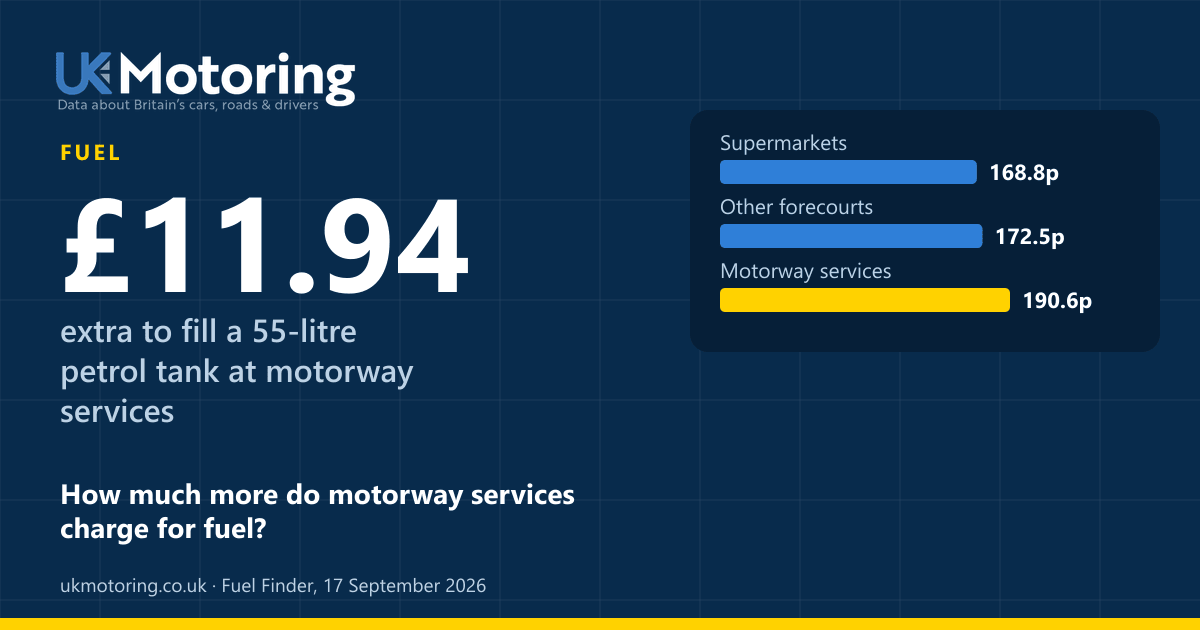
Supermarket petrol is 1.8p a litre cheaper on average than at other forecourts in South East.
| Forecourts | Petrol | Diesel | Stations |
|---|---|---|---|
| Supermarkets | 171.4p | 197.6p | 176 |
| Motorway services | 195.9p | 222.0p | 21 |
| Other forecourts | 173.2p | 199.9p | 628 |
Council areas, cheapest first
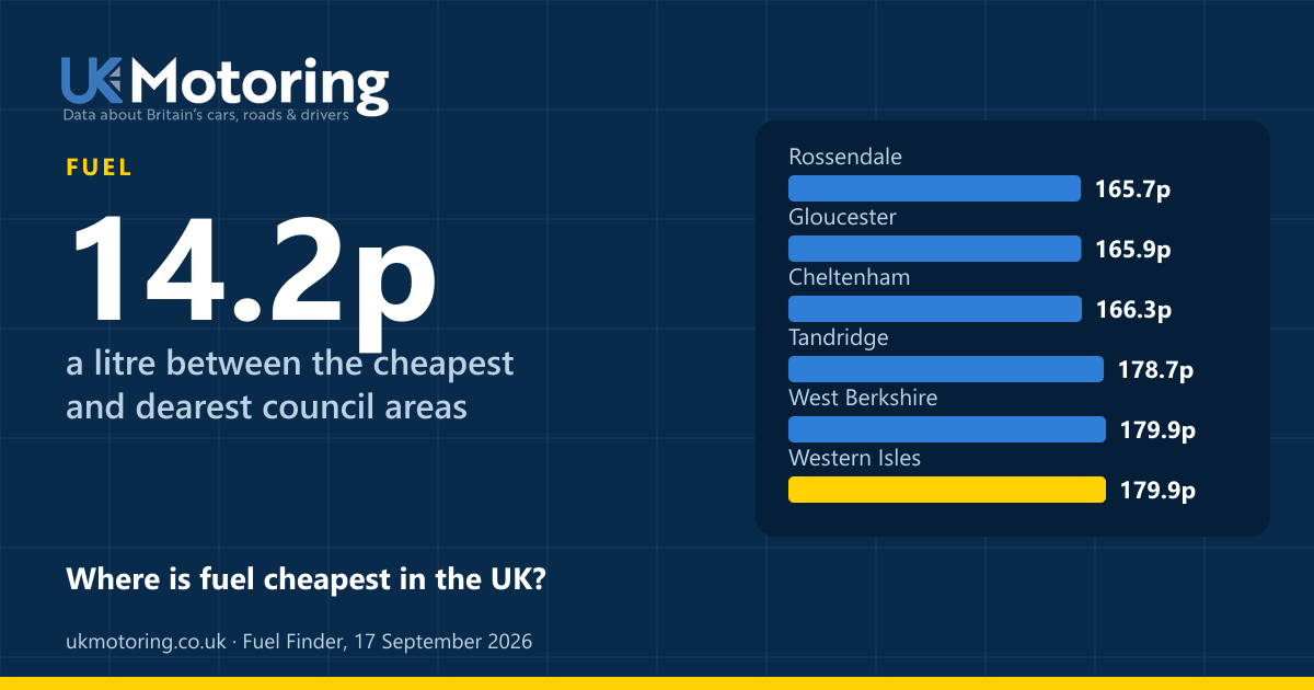
| Area | Petrol | Diesel |
|---|---|---|
| Thanet | 167.1p | 194.6p |
| Hastings | 168.6p | 197.5p |
| Runnymede | 169.6p | 197.0p |
| Rushmoor | 169.7p | 198.0p |
| Worthing | 169.7p | 195.6p |
| Vale of White Horse | 170.0p | 197.1p |
| Rother | 170.7p | 200.6p |
| Spelthorne | 170.8p | 198.6p |
| Adur | 170.9p | – |
| Havant | 171.0p | 198.7p |
| Eastbourne | 171.1p | – |
| Lewes | 171.1p | 198.9p |
| Guildford | 171.4p | 201.1p |
| Epsom and Ewell | 171.5p | 201.1p |
| Woking | 171.5p | 198.6p |
| Wealden | 171.8p | 199.6p |
| Surrey Heath | 171.9p | 198.0p |
| Mole Valley | 172.1p | 199.2p |
| Reigate and Banstead | 172.1p | 201.6p |
| Crawley | 172.1p | – |
| Gravesham | 172.2p | 197.9p |
| Bracknell Forest | 172.3p | 198.8p |
| Windsor and Maidenhead | 172.4p | 199.1p |
| Canterbury | 172.4p | 198.6p |
| Dartford | 172.4p | 199.9p |
| Sevenoaks | 172.4p | 200.6p |
| Elmbridge | 172.4p | 201.2p |
| Buckinghamshire | 172.6p | 200.0p |
| Portsmouth | 172.7p | 199.2p |
| Mid Sussex | 172.7p | 200.1p |
| Waverley | 172.8p | 201.3p |
| Cherwell | 172.9p | 197.9p |
| Slough | 173.0p | 199.2p |
| Brighton and Hove | 173.1p | 197.4p |
| Eastleigh | 173.1p | 199.7p |
| Southampton | 173.2p | 200.9p |
| Tonbridge and Malling | 173.6p | 200.8p |
| Tunbridge Wells | 173.7p | 197.0p |
| Wokingham | 173.8p | 200.9p |
| Arun | 173.8p | 199.7p |
| Reading | 173.9p | 199.9p |
| Chichester | 173.9p | 199.1p |
| Swale | 174.2p | 201.1p |
| Basingstoke and Deane | 174.3p | 198.0p |
| Oxford | 174.3p | 198.7p |
| Medway | 174.4p | 201.8p |
| Milton Keynes | 174.4p | 203.5p |
| East Hampshire | 174.4p | 200.7p |
| West Oxfordshire | 174.4p | 201.0p |
| New Forest | 174.7p | 200.7p |
| Ashford | 174.8p | – |
| Fareham | 174.9p | 199.4p |
| Gosport | 174.9p | – |
| Hart | 175.0p | 203.0p |
| Horsham | 175.1p | 199.5p |
| Dover | 175.2p | 199.3p |
| Folkestone and Hythe | 175.3p | 200.4p |
| Maidstone | 175.3p | 200.0p |
| South Oxfordshire | 176.2p | 199.0p |
| Winchester | 176.3p | 205.0p |
| Test Valley | 177.0p | 205.1p |
| Isle of Wight | 177.8p | 202.7p |
| Tandridge | 180.2p | 208.7p |
| West Berkshire | 182.7p | 210.4p |
Data stories to read next
Data sources and methodology
| Figures | Source | Period | Records | Updated |
|---|---|---|---|---|
| Forecourt prices | Fuel Finder open data Fuel Finder statutory scheme ONS Postcode Directory Office for National Statistics | Prices at 19:32 on 31 October 2026 | 8,148 filling stations | 31 October 2026 |
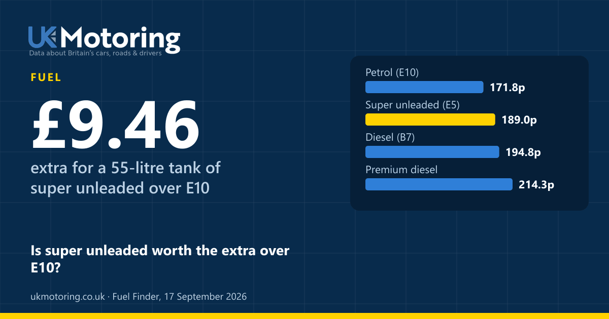
- Averages use unleaded (E10) and standard diesel (B7) prices at open forecourts, leaving out prices unchanged for over two weeks or far from every other forecourt. They count each forecourt once, not by how much fuel it sells.
- Forecourts are placed in council areas from their postcode, using the ONS Postcode Directory.
Source: Fuel Finder, the UK government’s statutory fuel price scheme.
Source: Office for National Statistics licensed under the Open Government Licence v3.0. Contains OS data © Crown copyright and database right 2026. Contains Royal Mail data © Royal Mail copyright and database right 2026.